

Aerospace Science and Technology (2018)
journal
Q1
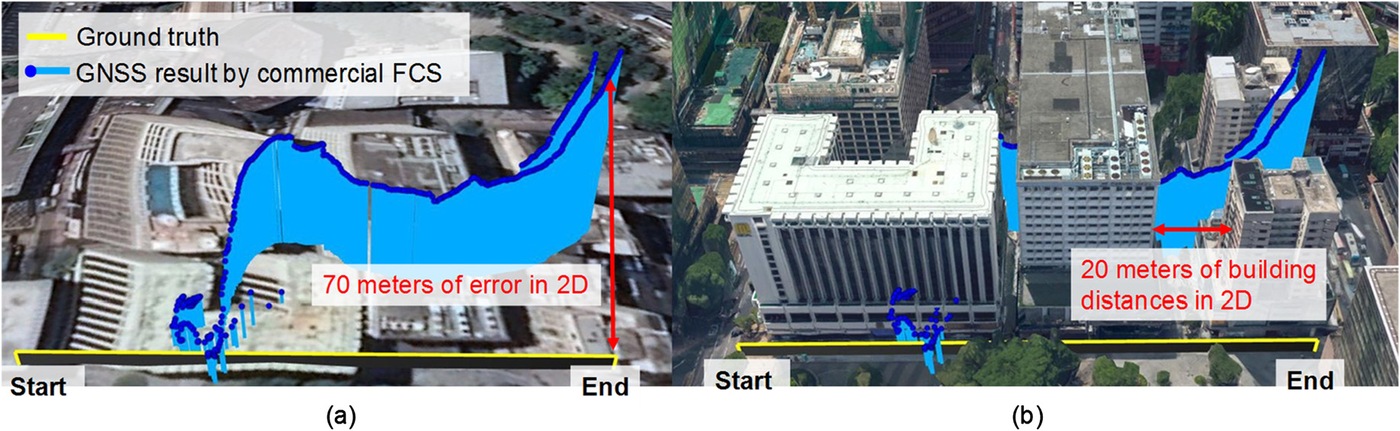
Key idea. GNSS feeding a commercial UAV flight controller can be off by 70 m in 2D where buildings are only 20 m apart (figure) — easily enough to fly into a wall. The paper builds an intelligent GNSS/INS integration for the flight control system that adapts the fusion when GNSS degrades in urban airspace.
Why it matters. Low-altitude urban UAV operations live or die on navigation integrity; this quantifies how bad off-the-shelf GNSS gets between buildings and shows an integration designed for those conditions. (Aerospace Science and Technology, 2018, Q1.)